Bodø
HELGELAND / LOFOTEN FERRY / COASTAL ROUTES
A coastal gateway for island roads, ferry crossings and journeys north toward Lofoten.
Open related guideInteractive field map
Trace quiet roads, Arctic islands, fjords and remote places worth slowing down for.
Preparing map
Travel times are approximate and meant for inspiration. Open routes in Google Maps for live directions, traffic and ferry updates.
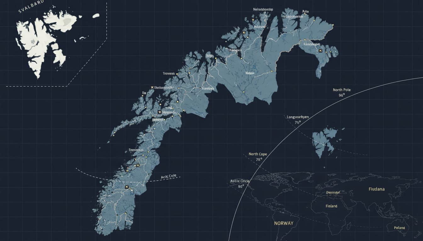
ARRIVAL MAP
Fly into Bodø, Evenes, Tromsø, Alta or Kirkenes — then continue by road, ferry and coastal routes into the landscapes that define the north.
HELGELAND / LOFOTEN FERRY / COASTAL ROUTES
A coastal gateway for island roads, ferry crossings and journeys north toward Lofoten.
Open related guideLOFOTEN / VESTERÅLEN / NARVIK
A practical arrival point for Lofoten, Vesterålen and the mountains around Narvik.
Open related guideARCTIC CITY / SENJA / NORTHERN LIGHTS
A natural starting point for Arctic light, city stays and slow routes toward Senja.
Open related guideFINNMARK / WINTER ROADS / ARCTIC SKY
A northern gateway for wide landscapes, winter light and remote Arctic road routes.
Open related guideEASTERN FINNMARK / BARENTS ROUTES / REMOTE ARCTIC
A far-north arrival for borderland landscapes and eastern Finnmark.
Open related guide